
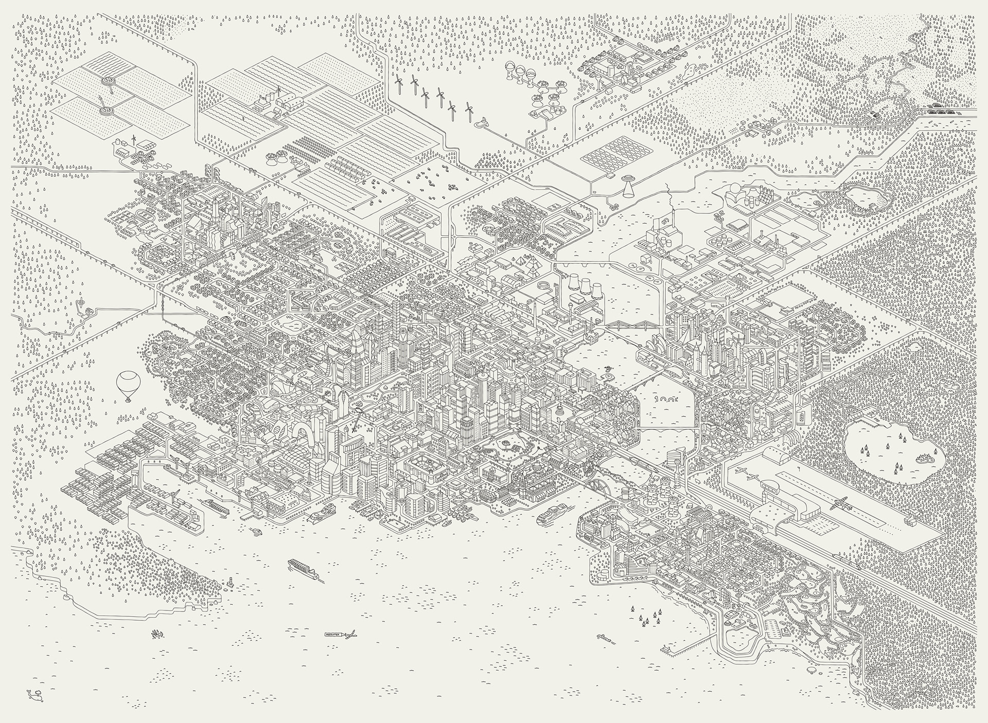
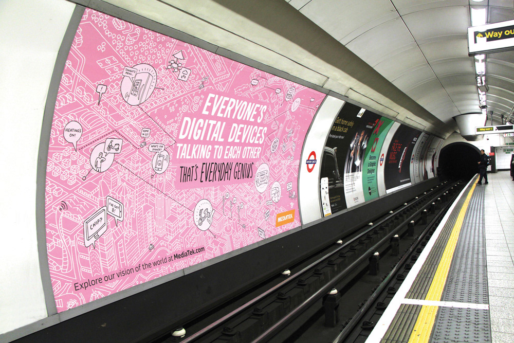
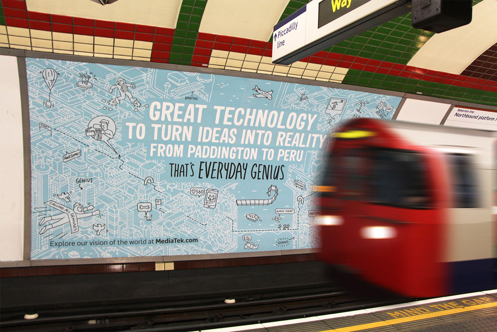

The largest illustrated map I've ever created! This took a week of solid drawing, creating and inventing a new 'city' complete with skyscrapers, roads, a metro network, financial zones, sports arenas, suburbs, power stations and farmland. Phew! The final design included many animated overlays, designed to bring the city to life. The illustrated map existed on the Mediatek website, where there were lots of 'clickable' areas for pull-out info, as well as loads of funny animated 'easter eggs'.
The illustrated map was also used across print media, with crops of the city related to Mediatek products forming the base of advertising posters across the London Underground.
Thanks to everyone involved, this was a great project!